 SIGHTING CONFIRMED
ISSQUATCH
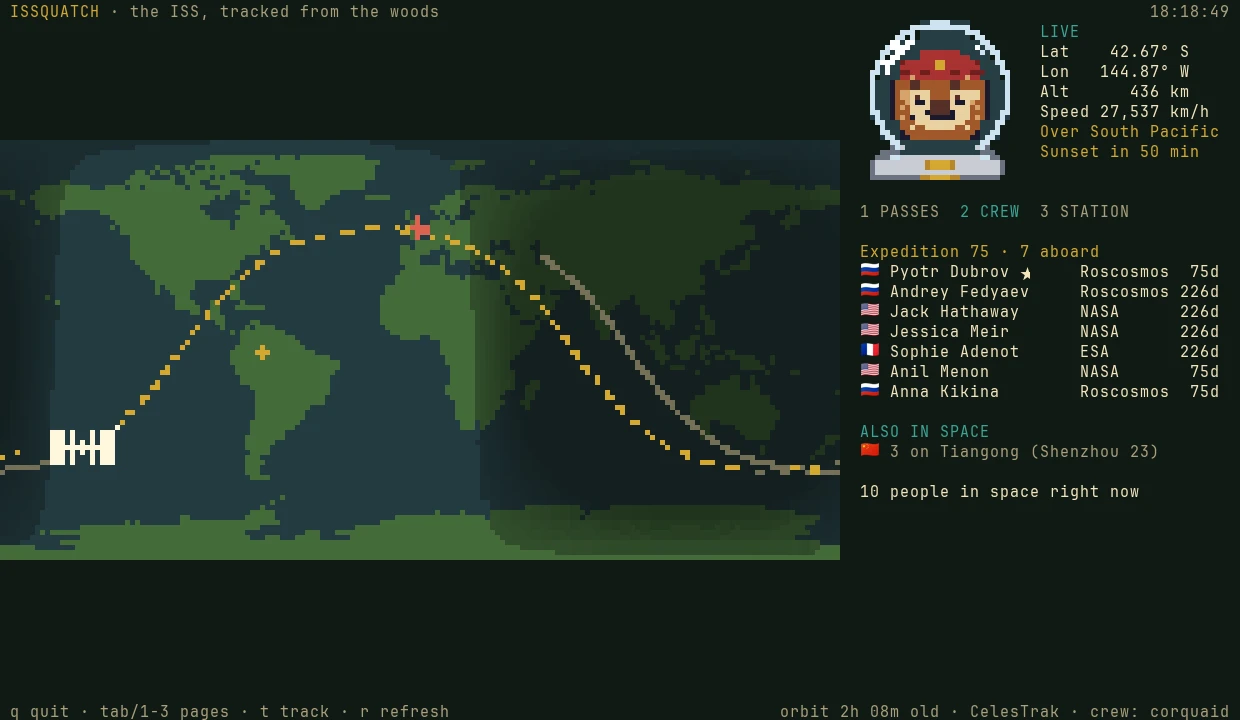
A floating ISS tracker for Omarchy. It shows where the station is and who's aboard, and sends a notification ten minutes before a pass you can see from home.
INSTALL
For Omarchy with the Lua Hyprland config. It needs Python 3.11 or later, which Omarchy already has.
$ curl -fsSL https://raw.githubusercontent.com/squatchware/issquatch/main/install.sh | bash
Then press Super Alt I to open it and l to set your location. The installer is short
and worth reading first: install.sh.
It backs up anything it edits, and rolls itself back if Hyprland reports a config error.
A HEADS-UP BEFORE EACH PASS
You can only see the station when the sun is lighting it and your sky is dark. That happens on a few evenings or mornings a week, for a few minutes at a time. issquatch works out when, and ten minutes before each pass it sends a desktop notification like this one:
A systemd timer does the checking every five minutes, so the map doesn't need to be open. Passes that stay below
20° are skipped, because trees and rooftops usually hide them. You can change the warning time and the cut-off in
~/.config/issquatch/config.toml, or install with ISSQUATCH_NOTIFY=0 to go without.
$ issquatch passes
ISS passes over London (local time)

  when              visible     max  path
  Sun 27 Sep 20:34  5m 20s      23°  W → SSE
  Tue 29 Sep 20:38  1m 50s      11°  WSW → SSW
THE PANEL
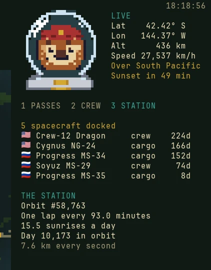
Next to the map are the live numbers: position, height, speed, the country or ocean below, and the minutes until the station's next sunrise or sunset. Under them are three pages.
IT FOLLOWS YOUR THEME
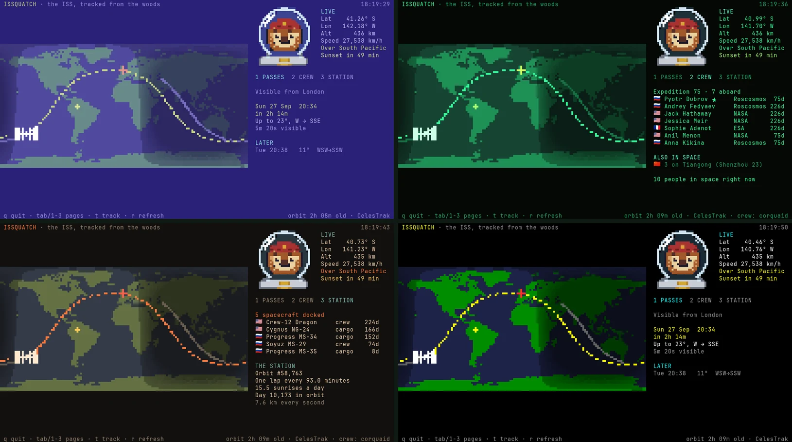
The colours come from your Omarchy theme's colors.toml, and the map redraws when you switch themes.
Here it is in four Retro Pack themes.
THE MANUAL
$ issquatch setup "Glasgow"   # or press l in the map
$ issquatch passes --week    # --all adds the unlit ones
$ issquatch crew             # who's aboard, with flags
$ issquatch now --json       # for scripts and bars
$ issquatch notify --test    # send the next alert now
WHAT IT TOUCHES
install.sh --uninstall removes all of it except your location.
HOW IT WORKS
The station's orbital elements come from CelesTrak and are propagated with SGP4, the model they're made for. Positions match wheretheiss.at to a tenth of a degree, and pass times match the Skyfield astronomy library to the second. The coastlines are Natural Earth's, drawn with Unicode 16 octants: eight square pixels to a character, or two in terminals that can't draw octants. About 850 lines of Python, MIT licensed.
When you set your location, the place name is looked up once with OpenStreetMap's Nominatim. After that, the only downloads are the orbit from CelesTrak and the crew list from corquaid's ISS APIs. The country below the station is worked out offline from Natural Earth's borders. Not affiliated with NASA or any space agency.
GET IT
Free and MIT licensed. Bug reports and pull requests are welcome on GitHub.